 Moderate
 Route 6 Vega del Jarama - Ciempozuelos
Ciempozuelos, Comunidad de MadridRoute 6 Vega del Jarama - Ciempozuelos
Ciempozuelos · Comunidad de Madrid 35.9km Distance
2h 50min Duration
684m Max altitude
e-Bike Type
Moderate Important: Warning: shared space with motor vehicles.
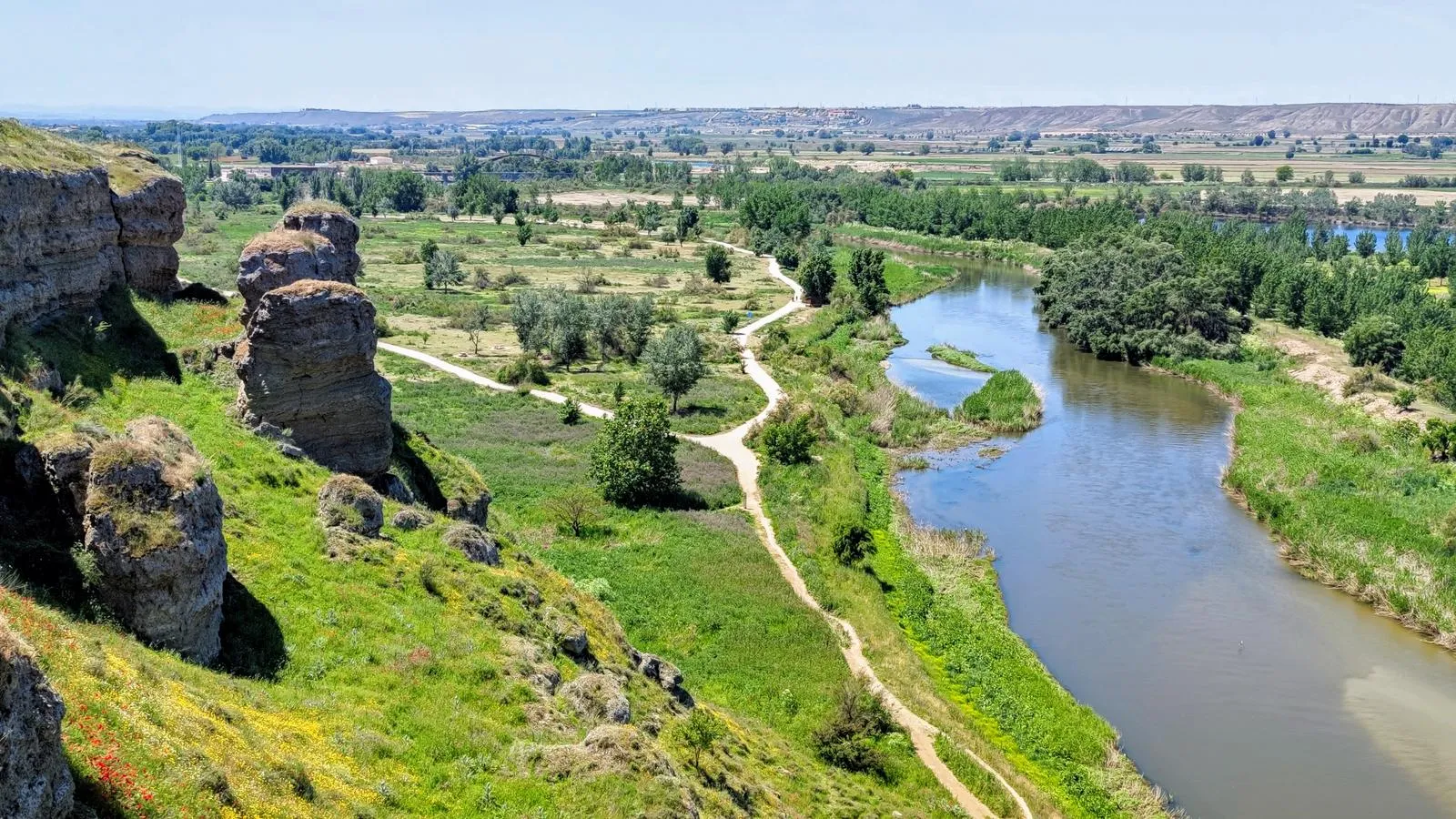
The Jarama River originates in the slopes of Peña Cebollera, in the mountain range where Madrid, Segovia, and Guadalajara converge, under the protection of the southernmost beech forests in Europe. The Jarama is the longest river in the Community of Madrid and, in its course through the Madrid plains, collects the waters from the southern slopes of the Guadarrama mountain range through the rivers Lozoya and Manzanares, creating an extraordinary river corridor in its lower course, integrated into the Regional Park of the Southeast.
The cycling route runs through the river valley of the Jarama, showcasing a remarkable set of ponds, wetlands, gypsum slopes, and riverside groves, alongside steppes and agricultural plains.
The route passes through Titulcia, a strategic town at the confluence of the Tajuña and Jarama rivers, with an important Roman archaeological site and a viewpoint at Soto de Bayona overlooking the lower course of the Jarama. A notable section follows the Cordel de la Galiana, one of the most important livestock routes in the Las Vegas region.
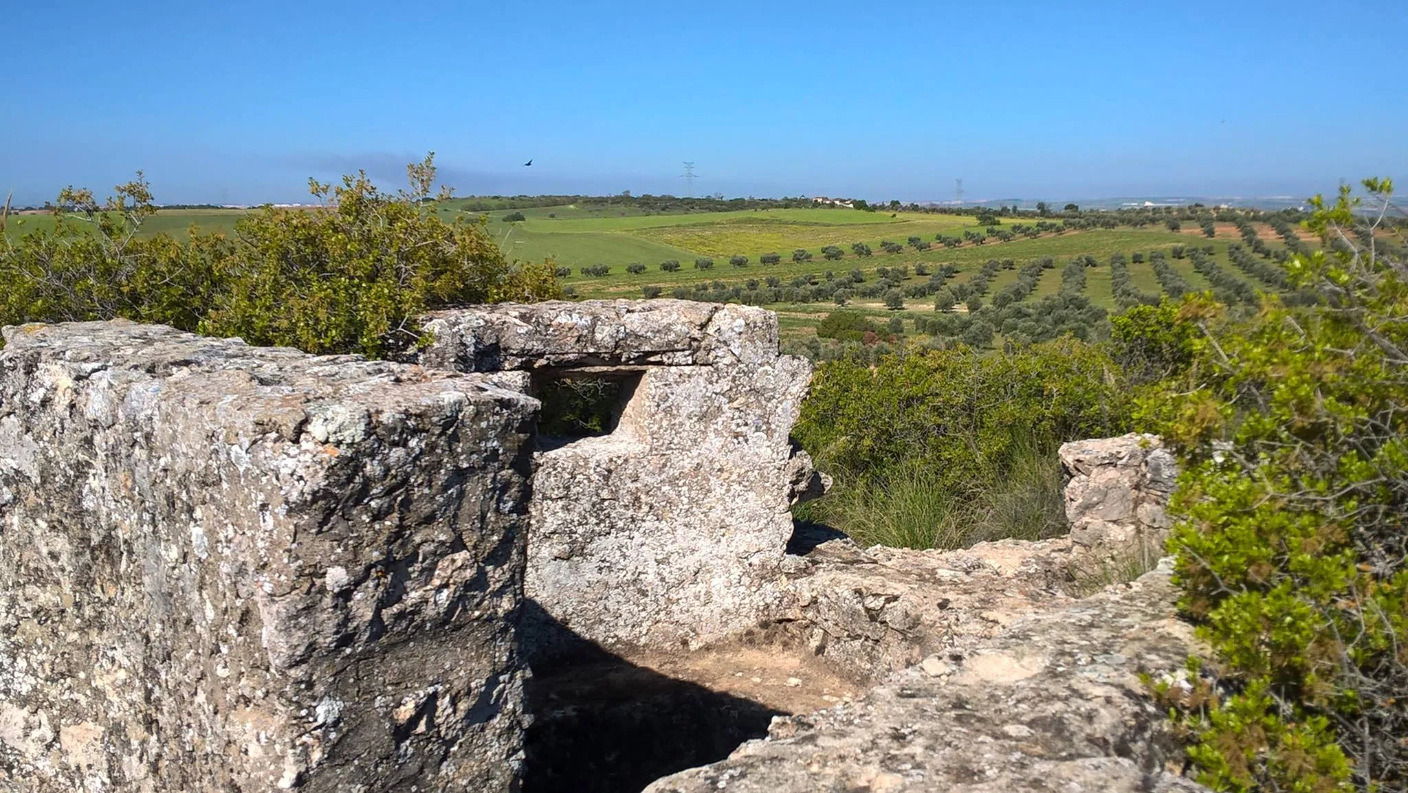
On the Cerro del Pingarrón, remains of fortifications, trenches, and bunkers from the Civil War are preserved. The river environment is particularly interesting for birdwatching in the riverside groves and the course of the Jarama.
Types of path
Mapa interactivo proporcionado por
Wikiloc open_in_newMoments captured by our community.
Discover unique places to stop and enjoy.
 forest Naturaleza
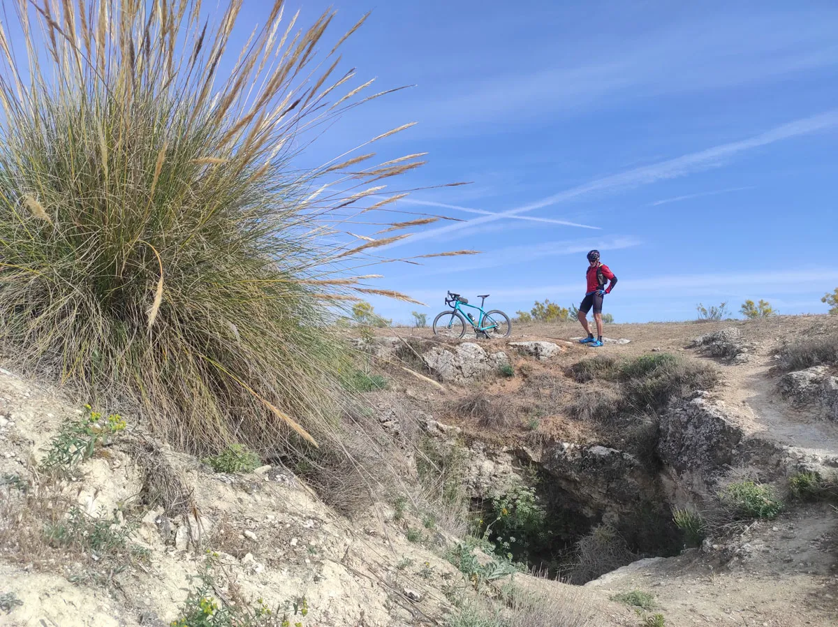
 A necessary stop in the aljezares of the Cordel de la Galiana to enjoy magnificent views of the lower course of the Jarama River. The Arabic term “al jez” means gypsum hill. In botany, gipsicolous scrub or aljezar refers to the complex plant ecosystem concentrated in the gypsum cliffs associated with the Miocene reliefs near the river valleys. The slopes of the Jarama are lands with poorly developed soils, low water retention capacity, and steep slopes exposed to erosion.
 forest Naturaleza
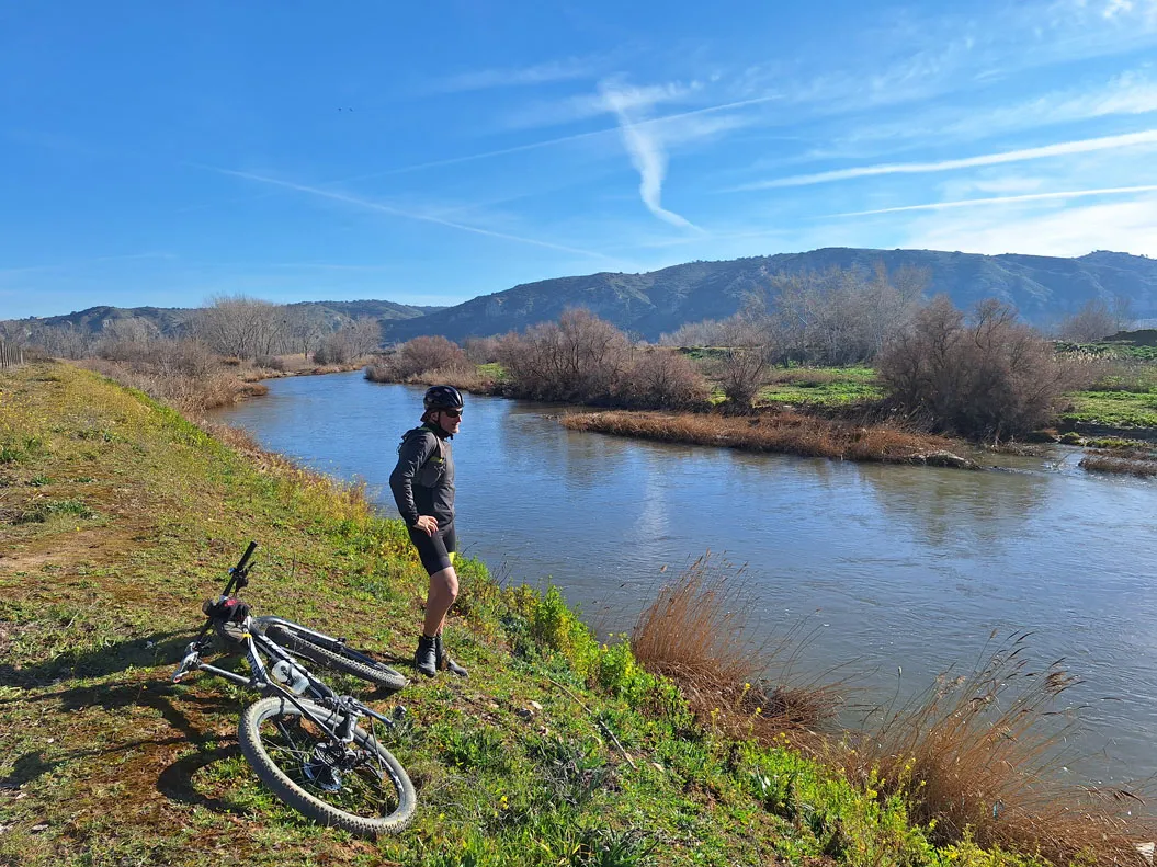
 The riverside woodland of the Jarama River is a true environmental lung in agricultural meadow and a valuable refuge for wetland ecosystems in the Southeast Regional Park. The riverine woods provide shelter and natural habitat for numerous species of birds and reptiles, promote soil stabilization on the slopes of the river basin, and maintain a forested separation between the farmland and the riverbed, necessary to withstand the pressure of agricultural activities on the natural course of the Jarama River.
 place Otro