 Easy
Easy Path to La Atalaya
Ciudad Real, Castilla-La ManchaPath to La Atalaya
Ciudad Real · Castilla-La Mancha 19.3km Distance
1h 15min Duration
691m Max altitude
e-Bike Type
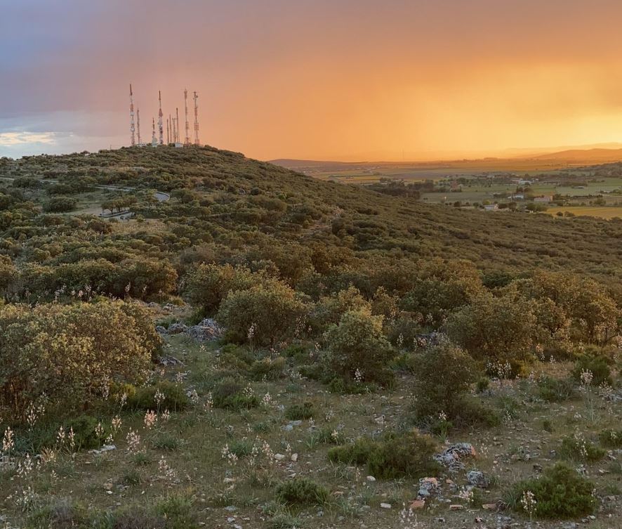
Easy We left the square heading towards Calatrava Street, until we crossed the Ronda and reached the UCLM Campus. We crossed to the Vereda de Moledores, which has a bike lane. We followed the path, crossed the small road, and it widened to allow for easy circulation on the path. We climbed the slope to enter the forest park, and continued along an asphalted path with a humid microclimate generated by the water deposits. Upon reaching the high point, we can enjoy 360-degree views, from Ciudad Real to Alarcos and Calatrava la Vieja, and the Guadiana River. We continued along the dirt path and found several deposits that serve as viewpoints. We ventured into the forest park along the dirt tracks, until we reached the recreational area of Atalaya. There we followed a small road that would end at the Vereda de Moledores, which takes us back to Ciudad Real. Once in the city, we traveled through the streets of the campus and sports area, entering via Mata Street to the city center. It is an easy route, with some slopes that are perfectly manageable with an electric bike. This route combines bike lanes, asphalted paths, and dirt roads. In the forest park, we can observe the fantastic views, as well as the flora and fauna of the area. Surely if we are attentive we can even see hares.
Mapa interactivo proporcionado por
Wikiloc open_in_newMoments captured by our community.