 Easy
Easy Circular Route Las Minas - Rubielos de Mora
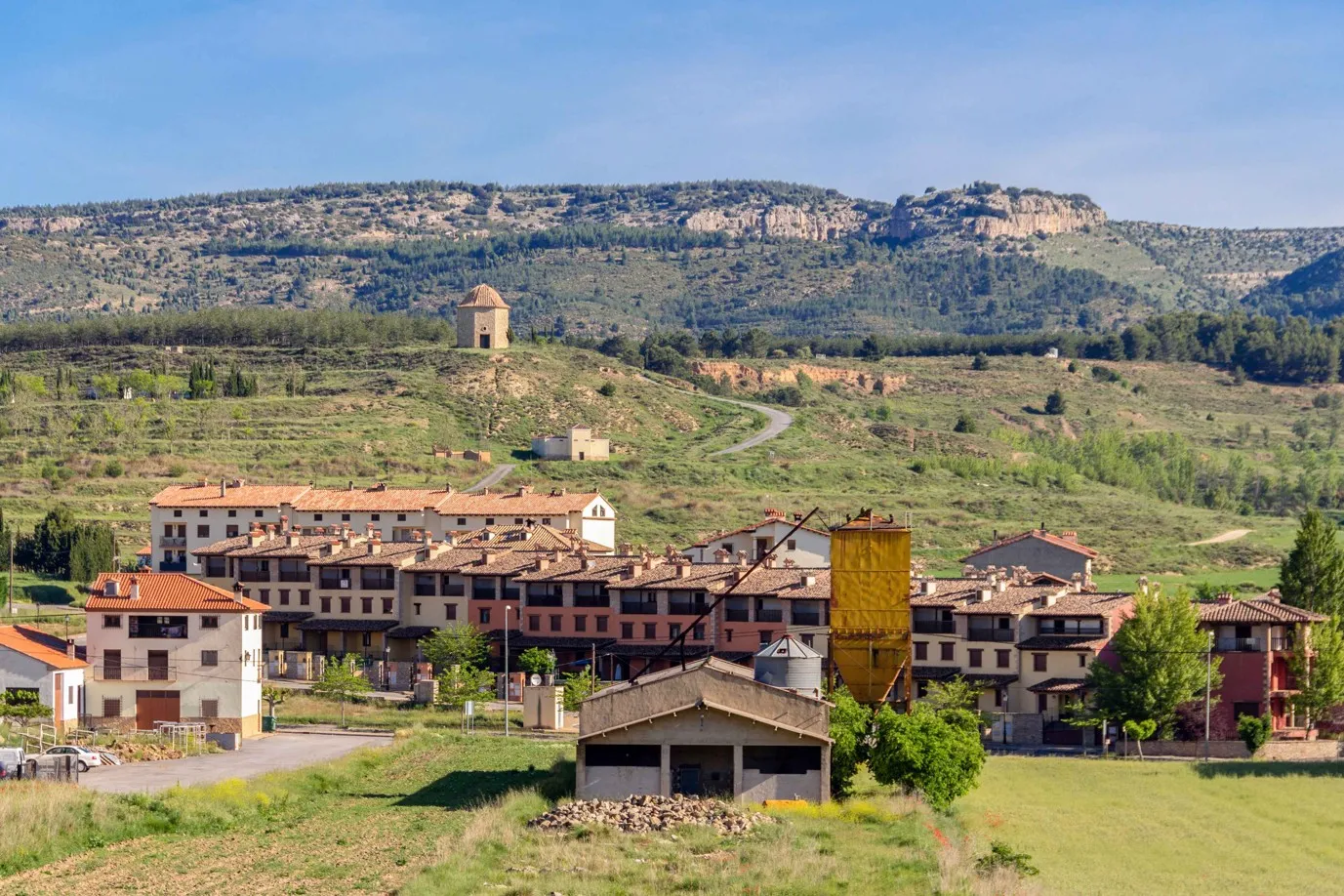
Rubielos de Mora, AragónCircular Route Las Minas - Rubielos de Mora
Rubielos de Mora · Aragón 15.2km Distance
1h 30min Duration
1013m Max altitude
e-Bike Type
Easy During the journey we cover a section of the PR TE 7, another section of the GR160 (Camino del Cid), we cross the Palomarejos river on two occasions, pass by two hermitages (San Antonio and Los Mártires), numerous farmhouses, pens, medieval bridges and visit the surroundings of Las Minas. The route is easy to follow, with no major elevation changes, although it tends to rise in the first section (upon leaving the village) and in the last section that leads us to Las Minas. It is highly recommended to bring some food and plenty of drink, especially in the summer months.
We leave the Town Hall heading southwest, towards the Neighborhood of the Virgin of Carmen. Upon reaching the neighborhood of the Cubes, we turn right, following the PR TE 7. After 2 kilometers we reach the Alto de la Venta, the highest point of the route (1,015 m), from where we can enjoy panoramic views of the entire area. From here, the descent to the medieval bridge (5 km from the start) begins, where, a few meters before, we will turn left to climb to the site of Las Minas.
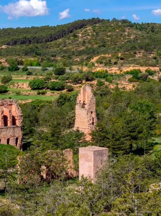
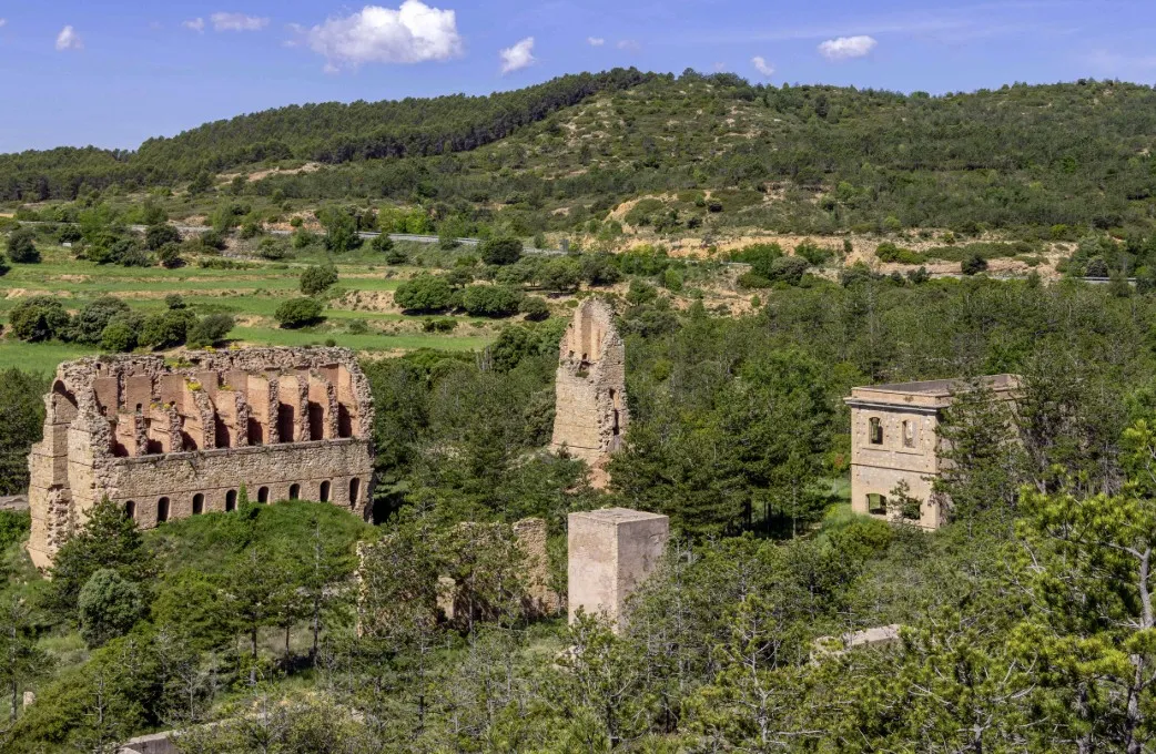
In this mining complex from the early 20th century, bituminous slate was extracted, from which, through distillation, oils used in chemical products and fuels were obtained. It is worth exploring the area and climbing to the base of the main chimney, from where the rest of the complex can be seen. Next to the Mines there is a youth camp, which usually hosts groups of young people during the summer.
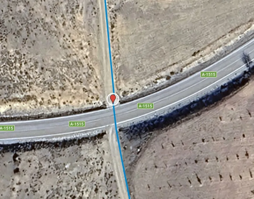
Once the visit is over, we go back the same way to the medieval bridge, from where we start the return journey to Rubielos, crossing the A 1515 road and passing by the Hermitage of Los Mártires, during the section of the Camino del Cid. In the final stretch of the route, we will pass through several paved sections, where we must take extra precautions, especially when following the A232, which connects Rubielos de Mora with Mora de Rubielos.
Another route to enjoy nature and the constructions found along the way. Don't forget your camera!
Mapa interactivo proporcionado por
Wikiloc open_in_newMoments captured by our community.
Discover unique places to stop and enjoy.
 place Otro
 The Alto de la Venta is one of the elevated points of the route in the surroundings of Rubielos de Mora, from where wide views of the mountainous landscape of the region can be enjoyed. A traditional stopping place, it marks one of the most open and panoramic sections of the route, ideal for stopping and contemplating the horizon.
 water_drop Agua
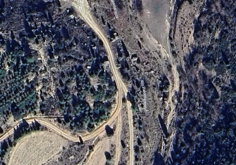
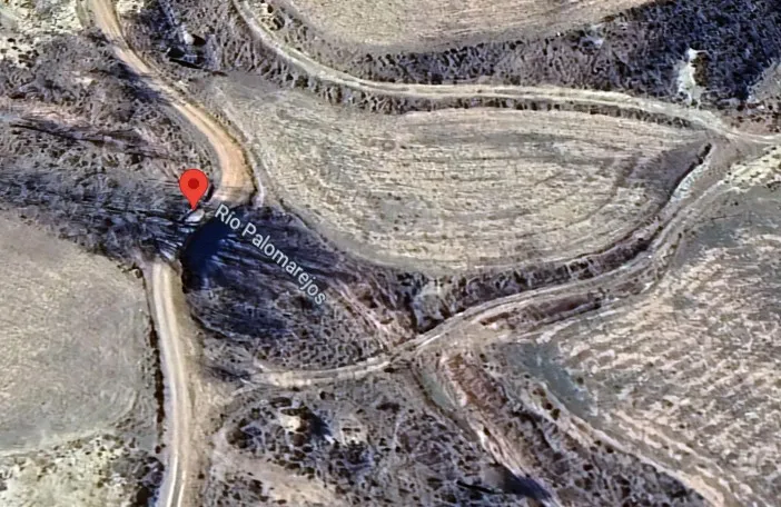
 The crossing of the Palomarejos River marks one of the freshest and most natural points of the route in the surroundings of Rubielos de Mora. Depending on the time of year, it may present greater or lesser flow, so it is advisable to exercise caution when crossing it, especially after rains.
 place Otro
 The Youth Camp Las Minas, located in the surroundings of Rubielos de Mora, is a facility intended for educational and recreational activities in the heart of nature. Surrounded by pine forests and close to the ancient mining site, it is a space frequented by school groups and summer camps.
 place Otro
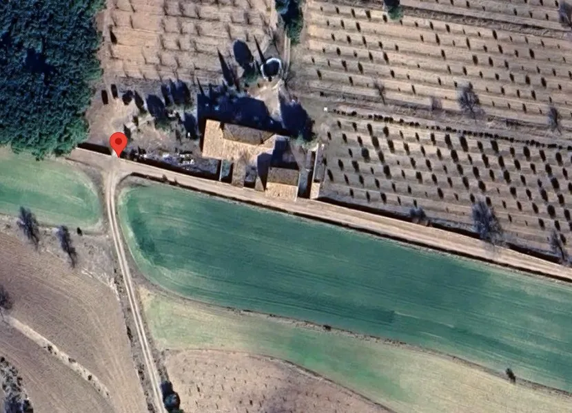
 The Entrance to the Boluda Farm marks the access to one of the traditional rural constructions in the vicinity of Rubielos de Mora. These farmhouses, historically linked to agricultural and livestock activities, are part of the cultural landscape of the region and evoke the self-sufficient life of yesteryear.
The Canaleta Fountain is a traditional stone fountain located in the rural area of Rubielos de Mora. In the past, it supplied water to locals and livestock, and today it serves as a pleasant resting point along the route, where one can refresh and enjoy the scenery.
 place Otro
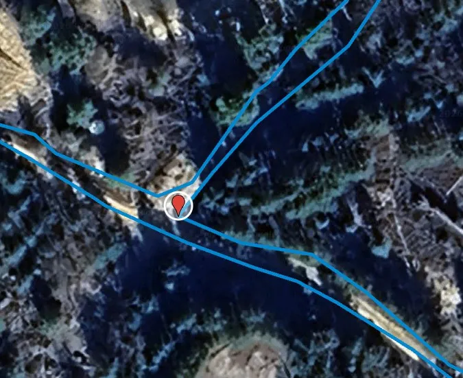
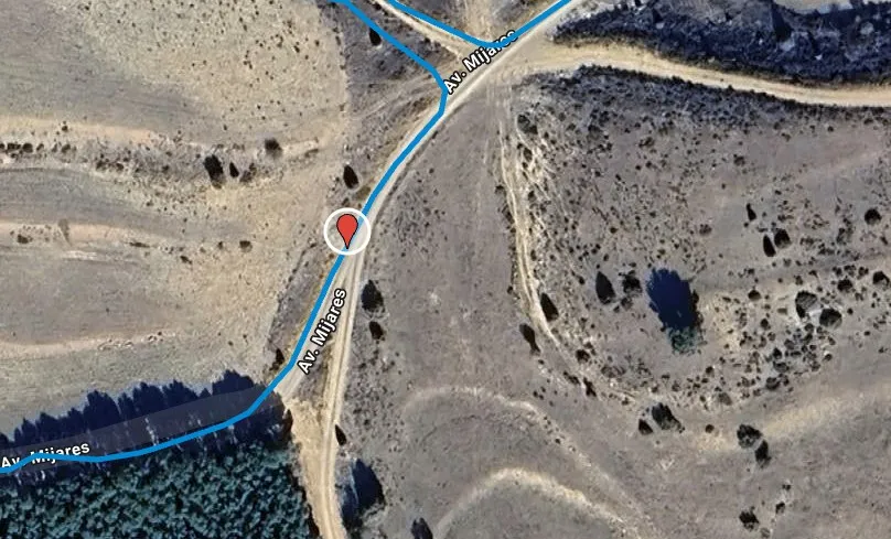
 GJ-RM-6.Point of the route where the main path is abandoned to turn left towards Las Minas. It is important to pay attention at this crossing, as it marks the access to the section linked to the old mining site in the vicinity of Rubielos de Mora.
 place Otro
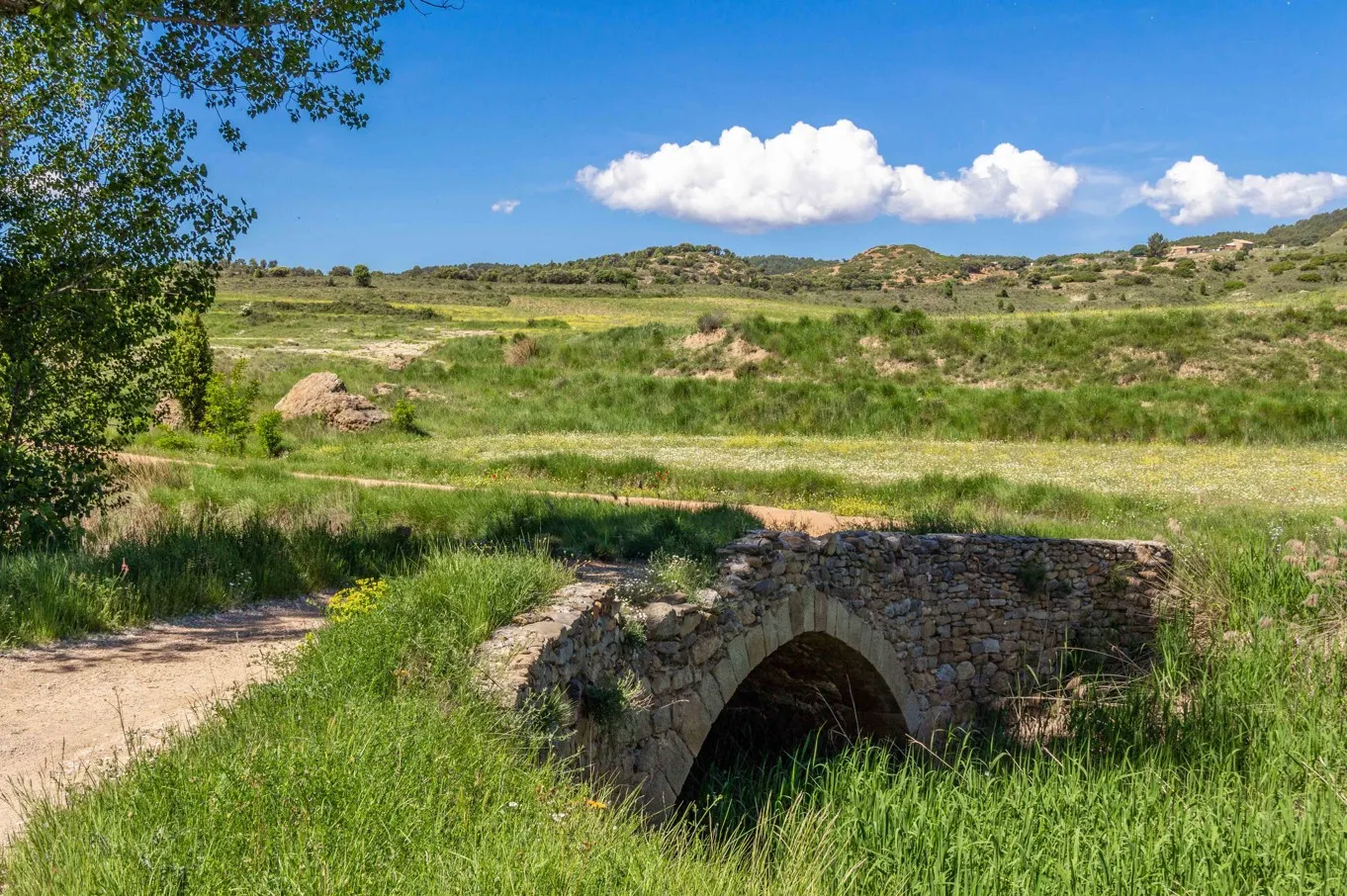
 Small bridge that crosses the Palomarejos River.
 castle Edificio
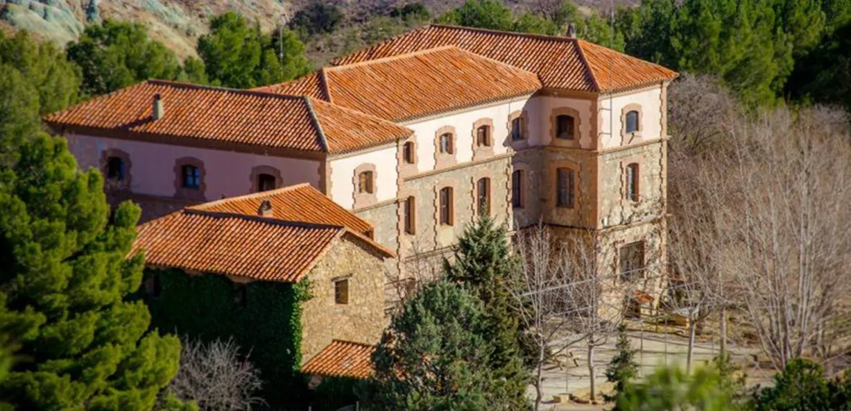
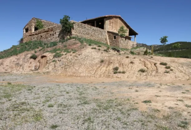
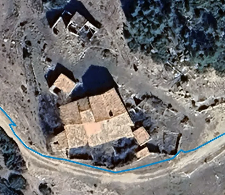
 The Masía La Viña is a traditional rural construction located in the surroundings of Rubielos de Mora. These masías, scattered throughout the territory, reflect the agricultural and livestock lifestyle that historically characterized the region, integrating harmoniously into the mountainous landscape.
 castle Edificio
 The Hermitage of the Martyrs, located in the vicinity of Rubielos de Mora, is a small temple of rural character linked to the local religious tradition. Simple and sober, it is part of the historical heritage of the municipality and constitutes a point of cultural interest within the route.
 place Otro
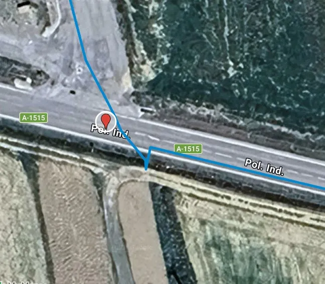
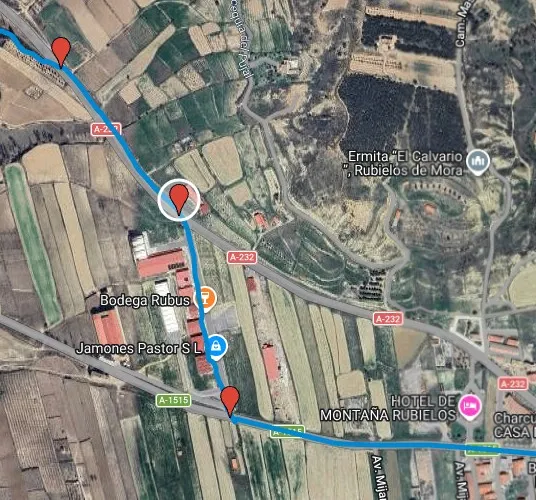
 It is recommended to exercise extreme caution in this section, paying attention to traffic and ensuring proper visibility before maneuvering.
 place Otro
 Point where the section ends on the A-232 road, in the vicinity of Rubielos de Mora, resuming the route on a track or rural road. After this section shared with vehicular traffic, it is recommended to merge carefully into the new layout.
 place Otro
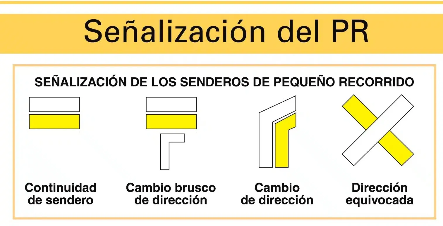
 The PR-TE 7 is a certified Short Distance trail that runs through the natural surroundings of Rubielos de Mora. It is marked with the characteristic white and yellow signs, and allows you to discover pine forests, traditional paths, and ancient mining remnants.
 place Otro
 Point where the route coincides or crosses the path of the Camino del Cid, a cultural itinerary inspired by the figure of Rodrigo Díaz de Vivar. This crossing adds a historical appeal to the journey, connecting it with one of the great cultural routes of Spain.
 place Otro
 Point where the section that runs along the A-232 road begins, an autonomous road that crosses the surroundings of Rubielos de Mora. It is recommended to drive with caution and in a line, respecting traffic regulations and paying attention to vehicular traffic.
 place Otro
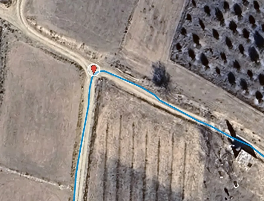
 GJ-RM-6. Point of the route where the path leaves the main track and turns right. It is important to pay attention to the signage at this intersection to avoid going straight and deviating from the planned itinerary.
place Otro GJ-RM-6.Point where the road leads to the enclave of Las Minas, an old mining exploitation area in the surroundings of Rubielos de Mora. This crossing marks the access to the section most linked to the industrial history of the area.
 castle Edificio
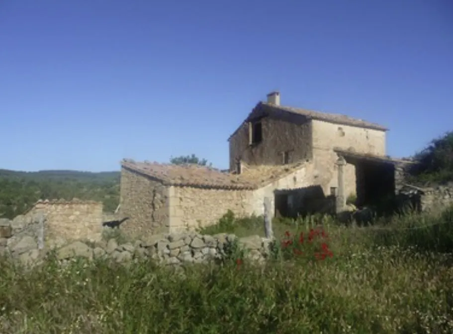
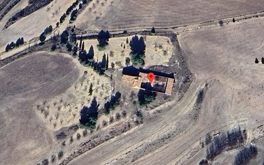
 The Mas de Martín is an ancient traditional farmhouse in the area of Rubielos de Mora, an example of the characteristic dispersed rural architecture of the region. These constructions linked to agricultural and livestock activities are part of the historical landscape of the comarca and evoke the self-sufficient life of yesteryear.
 place Otro
 The Mines are an ancient mining exploitation site located in the area of Rubielos de Mora. Although today nature has reclaimed much of the space, remnants of the extractive activity that was part of the local economy for decades can still be observed.
 place Otro
 GJ-RM-6. It is recommended to exercise extreme caution in this section and cross only when there is good visibility and no traffic.