 Hard
Hard Geo-Route Sierra del Cujón
Molinicos, Castilla-La ManchaGeo-Route Sierra del Cujón
Molinicos · Castilla-La Mancha 34.3km Distance
3h 24min Duration
1543m Max altitude
e-Bike Type
Hard Medium mountain itinerary that starts from the surroundings of Molinicos and progressively ascends through tracks and forest paths to the Sierra del Cujón, one of the most prominent reliefs in the eastern sector of the Sierra del Segura. The round trip route runs between pine forests of laricio pine and common juniper, crossing limestone areas with abundant karst forms and panoramic views over the valley of the Mundo River. Along the route, various geological interpretive panels are located that explain the formation of the relief and the characteristic rocks of the region.
Physically demanding route due to its length and accumulated elevation, although without notable technical difficulties.
Mapa interactivo proporcionado por
Wikiloc open_in_newMoments captured by our community.
Discover unique places to stop and enjoy.
 place Otro
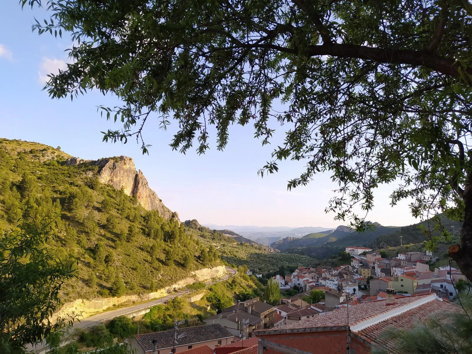
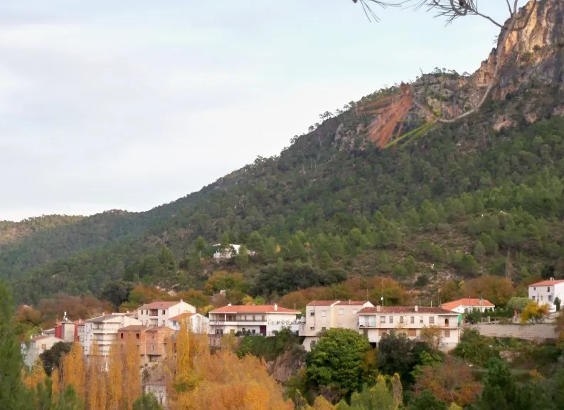
 Viewpoint located in the upper part of Molinicos, which offers a wide view of the urban area and the valley that surrounds it. From this point, the stepped arrangement of the village over the limestone relief and the confluence of small tributary ravines of the Mundo River can be clearly appreciated. It is an excellent visual start to understand the geographical position of the municipality within the Sierra del Segura.
 place Otro
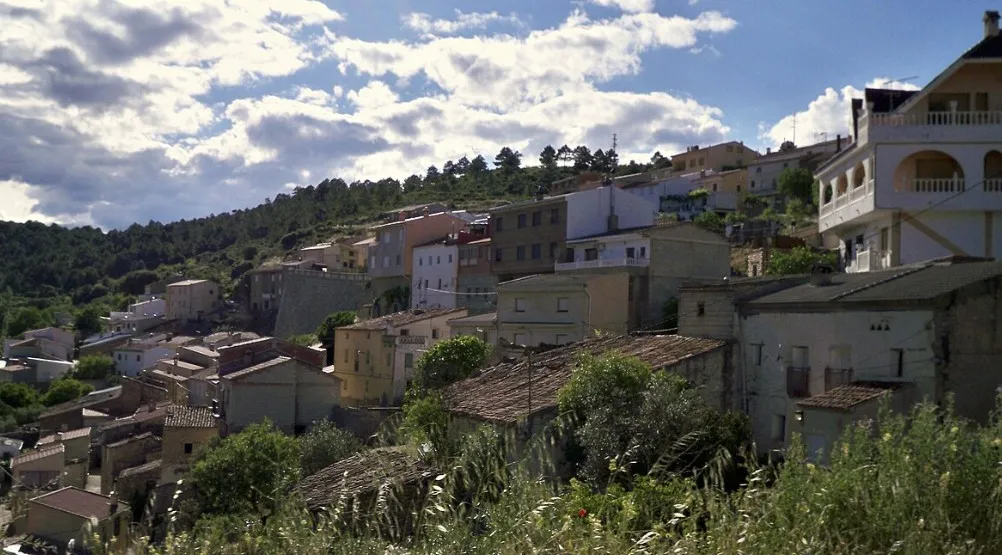
 Scenic viewpoint located next to the village of El Pardal, from which the valleys and forested hills of the surroundings of Molinicos can be dominated. It allows observing the transition between the cultivated areas and the mid-mountain pine forest, as well as the structural arrangement of the limestone relief. It is an excellent place for the landscape interpretation of the southern sector of the Sierra del Cujón.
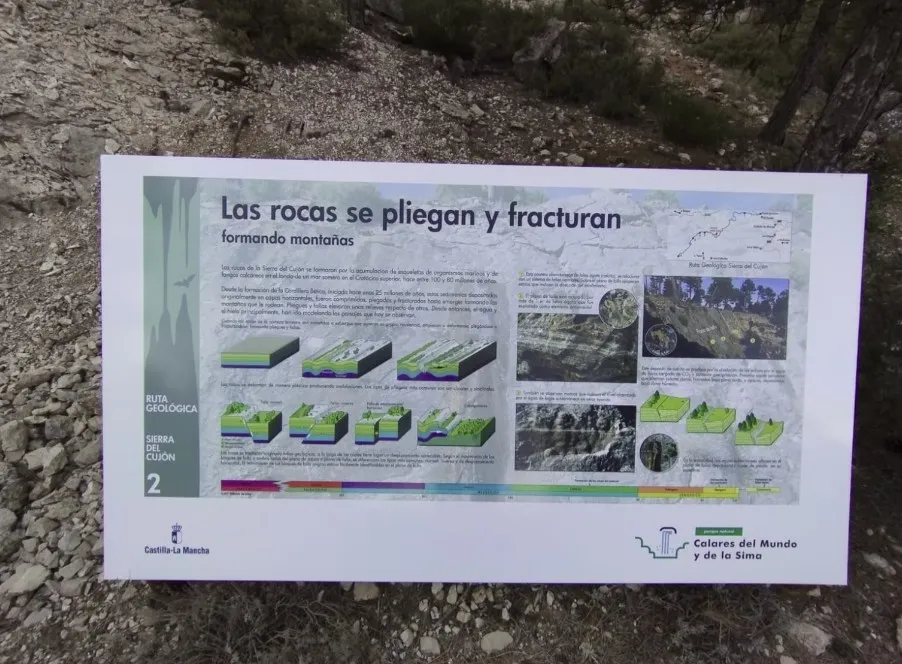
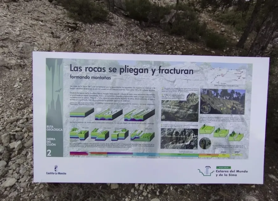
Punto inicial de la Geo-Ruta, donde se introduce el contexto geológico y geomorfológico de la Sierra del Cujón. Explica la composición caliza del macizo, su pertenencia al dominio Prebético y el origen de las principales formas kársticas visibles a lo largo del recorrido. También orienta sobre el trazado de la ruta y los objetivos interpretativos de cada panel.
 place Otro
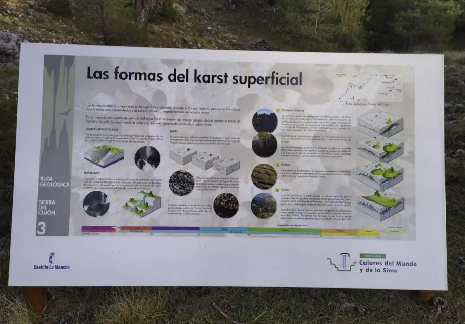
 Explain the erosive and modeling role of water in karst relief. Lapiaz, dolines, and sinks formed by the dissolution of limestone are observed.
 castle Edificio
 Area conditioned as a rest area and forest shelter, located in a clearing of the pine forest before the final ascent to Peña Bolomba. It has stone benches and tables, and serves as a regular stopping point for hikers. Its surroundings, surrounded by laricio pine and common juniper, offer shade and a cool microclimate even in summer.
 place Otro
 Introduce the types of rocks present in the Sierra del Segura: limestones, marls, and dolomites from the Mesozoic, as well as their arrangement in strata and folds.
 castle Edificio
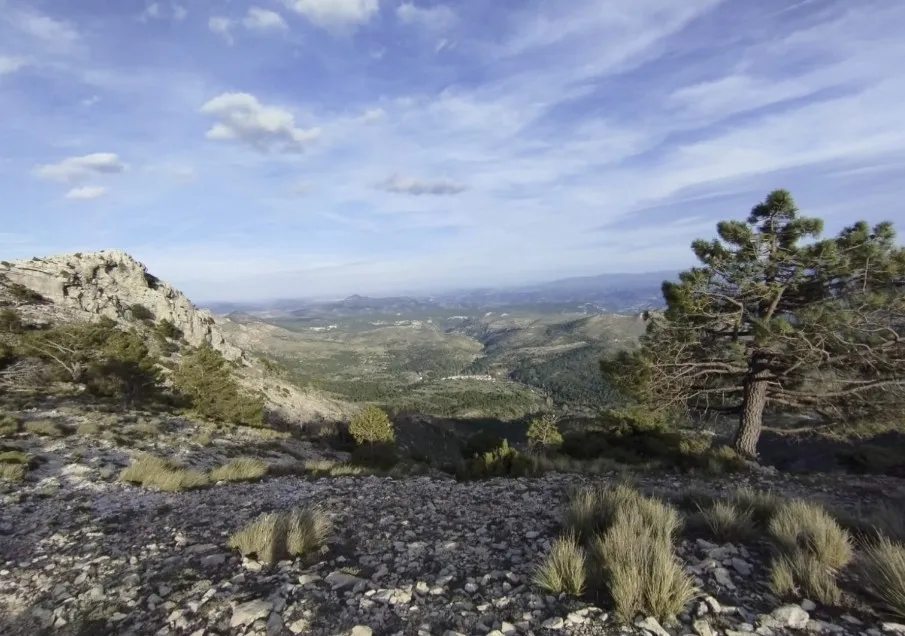
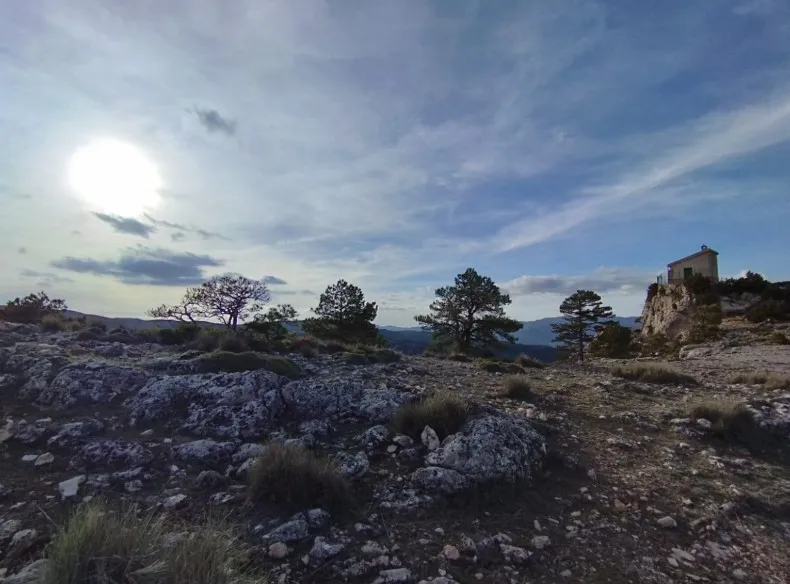
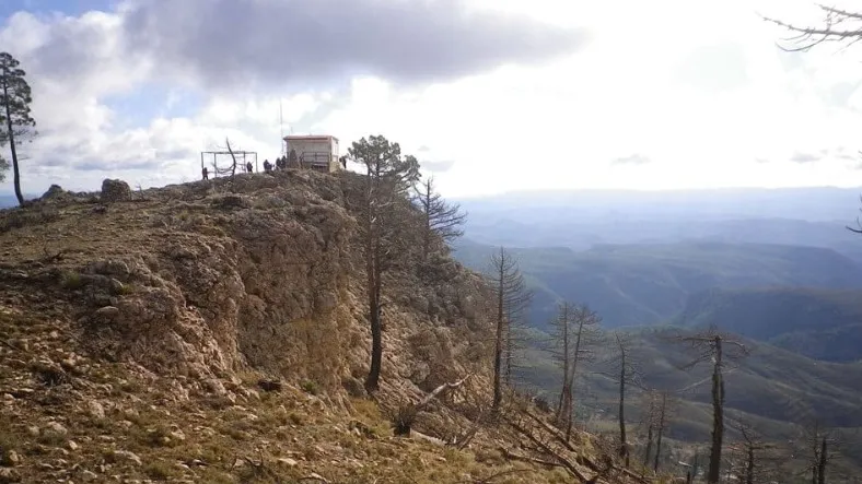
 Highest point of the itinerary (≈1,548 m). Rocky platform with a forest watchtower and panoramic views of the Calar del Mundo and the Sierra de las Cabras.
 place Otro
 Describe the surface forms of karst —lapies, dolines, and uvalas— and how rainwater has been slowly dissolving the limestone.
 place Otro
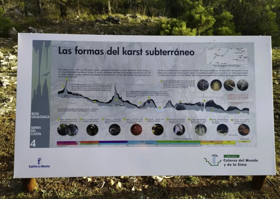
 It exposes the genesis of caves and sinkholes formed by the infiltration of water. Nearby, there are small cavities with the presence of stalactites.
 place Otro
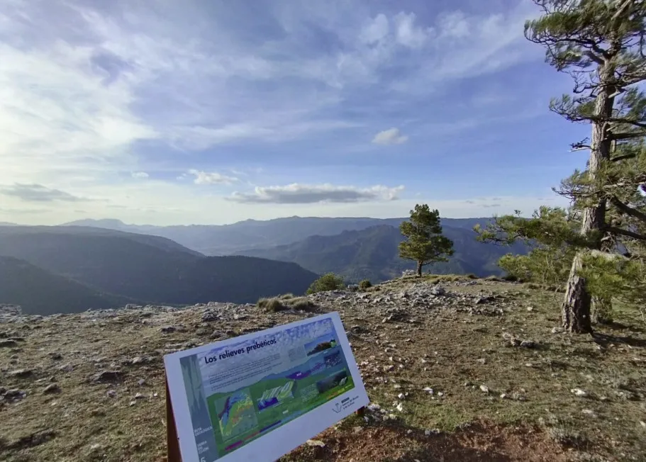
 Interpretation of the structural relief of the Sierra del Segura, with anticlines, synclines, and mountain alignments oriented NE-SW, typical of the pre-Betic domain.
 forest Naturaleza
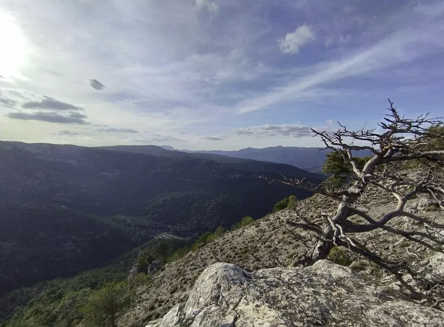
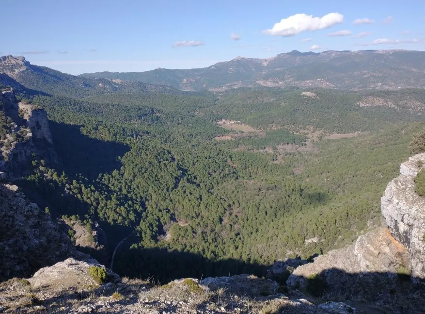
 Viewpoint located on the upper slope of the Sierra del Cujón, oriented towards the deep gorge of the Mundo River valley. From this point, a wide panorama of the ravines and forested hills is obtained, with a clear dominance of laricio pine over limestone substrate. It is a key place to interpret the erosive action of the river and the contrast between the steep slopes and the upper structural platforms.
 place Otro
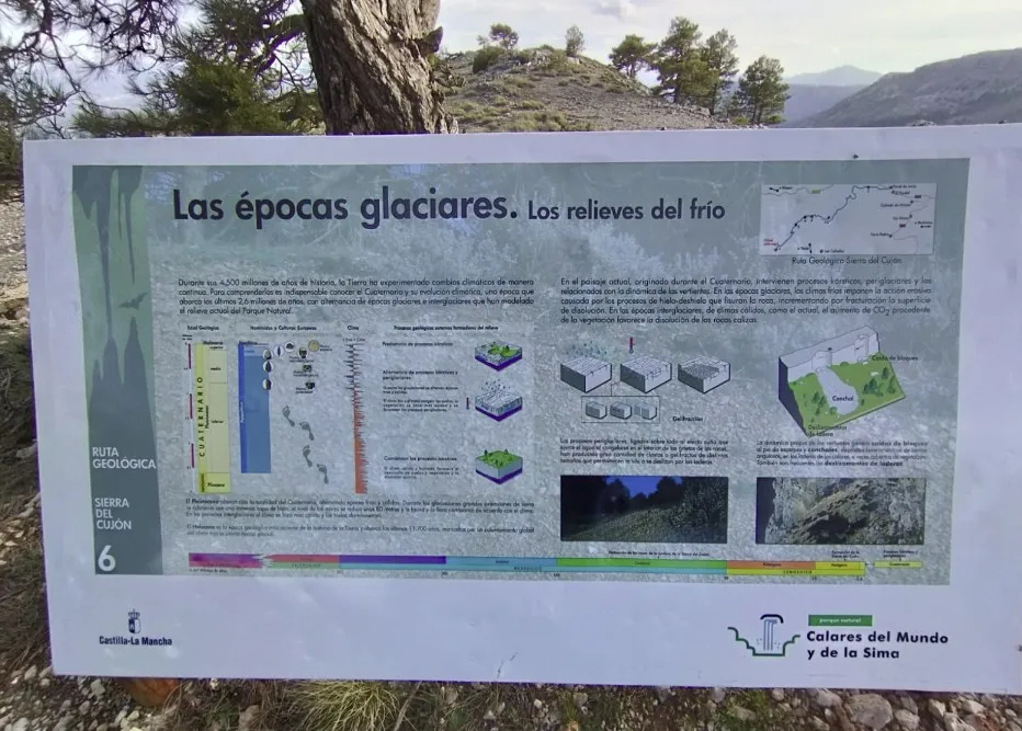
 Explain the influence of the cold climates of the Quaternary on the vegetation and the shaping of the current landscape.
 forest Naturaleza
 Observation point of the entrenched relief of the valley and the forest environment. It allows understanding the relationship between fluvial erosion and limestone lithology.
Highest point of the route (≈1,548 m). Offers wide panoramic views of the valley of the Mundo River, the Sierra de las Cabras, and the Calar del Mundo.