Teresian Route
Follow the footsteps of Saint Teresa of Jesus by electric bike through Castile
About the Teresian Route
The Teresian Route travels through the places that Saint Teresa of Jesus visited during her life, connecting historic cities full of religious and cultural heritage. A spiritual and cultural journey through Spain's Golden Age.
Discover by electric bike convents, churches, medieval walls and Castilian landscapes that inspired one of the most important figures of Spanish mysticism.
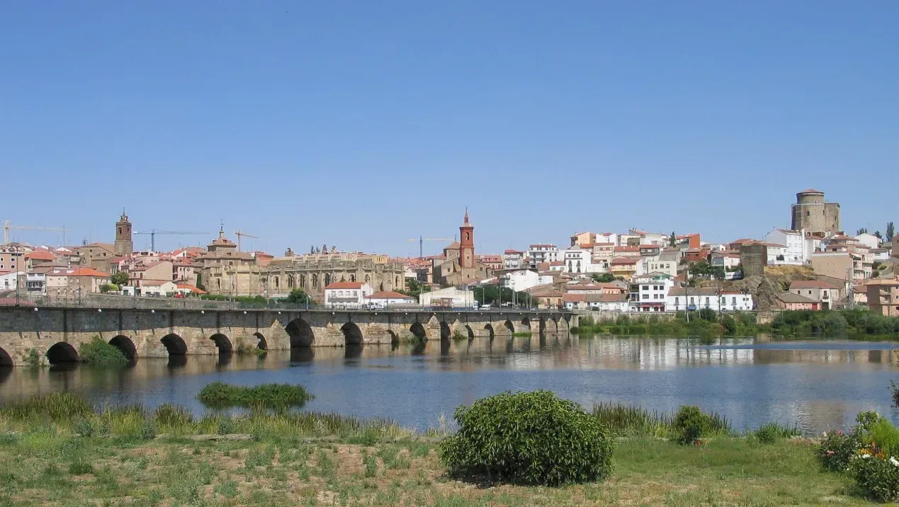
Mapa de la Comarca
3 destinosFeatured routes
Discover the paths that connect these unique destinations.

Path to the Hermitage via the Greenway
Alba de TormesThis circular route combines rural paths, open landscape, and a pleasant stretch along the Greenway, allowing you to discover the natural surroundings of Alba de Tormes and enjoy beautiful views of the Tormes River valley.
The route begins near the town, taking a wide dirt path that leads into the open countryside. From the first kilometers, wide panoramas of Alba de Tormes can be enjoyed, whose profile appears in the background dominating the landscape.
As we progress, the path winds between gentle hills and cultivated fields, where in spring the almond trees in bloom stand out, adding a touch of color to the landscape. The surface is comfortable and allows for peaceful cycling.
The route continues towards an elevated area from which beautiful views of the Tormes valley can be obtained, before starting the return towards the town.
In the final stretch, the route connects with the Silver Greenway, an old railway line now converted into a comfortable natural path. This stretch is particularly pleasant, with wooden railings and a very smooth surface, ideal for enjoying cycling without haste.
Before finishing the route, the path approaches again the Tormes River, where the landscape changes and riverside vegetation appears. From here, beautiful views of the bridge and the historic center of Alba de Tormes can be obtained, marking the end of the route.
This is a varied, simple, and very pleasant route, combining rural paths, nature, and heritage, ideal for discovering the surroundings of Alba de Tormes while cycling calmly.
Types of paths:
- Path: 5.86 km
- Narrow trail: 1.59 km
- Road: 1.44 km
- National road: 1.04 km
- Street: 879 m

Butterfly Route - Alba de Tormes
Alba de TormesThis pleasant route runs along the Greenway Silver Route, in the surroundings of Alba de Tormes, following the old railway track converted into a natural corridor where nature and landscape combine harmoniously.
The route begins on a wide and well-maintained path, with a compact and comfortable surface for cycling. From the first meters, you can enjoy wide views of the open landscape of the Salamanca countryside, with gentle hills and fields stretching to the horizon.
Along the way, flowering almond trees and native vegetation appear, which in spring transform the surroundings into a spectacle of colors and aromas. These spaces are part of the well-known Butterfly Path, a project that recovers the old railway trench as a refuge for biodiversity, especially for different species of butterflies and pollinators.
The route continues between wooden railings and gentle hills, offering very pleasant sections for leisurely cycling. From some elevated points, beautiful panoramas of the Tormes River valley and the silhouette of Alba de Tormes open up, appearing in the background dominating the landscape.
During the journey, it is easy to find interpretive panels and areas to observe local flora and fauna, making this route an experience that combines nature, landscape, and environmental education.
Thanks to its gentle profile and the comfort of the old railway track, it is a very accessible route, ideal for enjoying cycling without hurry and stopping to contemplate the landscape, photograph the flowering almond trees, or simply enjoy the silence of the countryside.
The return is made by the same path, allowing you to continue enjoying the views of the valley and the natural surroundings that accompany the entire route.
Types of paths:
- Narrow path: 2.64 km
- Road: 1.56 km
- National road: 1.06 km
- Street: 362 m
- Path: 285 m

Alba de Tormes circular route along the Tormes River
Alba de TormesThis circular route starts from Alba de Tormes and follows the course of the Tormes River, offering a tranquil and scenic ride ideal for electric bicycles. Along the way, it traverses compact dirt paths, riverside trails, and small paved sections, always close to the natural surroundings provided by the Tormes riverbed. The distance ranges from 20 to 30 kilometers, with little elevation change, making it an accessible option for cyclists of all levels. The route allows for views of the river, riverside areas with native vegetation, and some resting areas ideal for stopping and appreciating the landscape. The route is perfect for a relaxed outing, combining nature and heritage, as at the beginning or end you can visit the historic center of Alba de Tormes. It is advisable to bring water, some light food, and check the condition of the bicycle before starting.
Notice:
There is a section where you will have to get off the bike and push it. 84 m in total.
Types of Path:
- Bicycle lane: 12.6 km
- Road: 12.0 km
- Path: 8.19 km
- Narrow trail: 2.25 km
- Street: 814 m
- National road: 521 m
- Other ways: < 100 m

Route: Surroundings of Ávila and Route along the Adaja River
ÁvilaThis route circles the natural and heritage environment of Ávila, offering a privileged view of its medieval walls from different points along the way. The itinerary combines wide paths, comfortable trails, and rural tracks that run through open fields and gentle undulations. After skirting the city, the route descends toward the Adaja River, where the landscape becomes cooler and more wooded. It is a varied route, without technical difficulties, ideal for enjoying by bicycle while taking in panoramic views of Ávila and exploring one of its most characteristic natural areas.
Types of path:
- Path: 14.3 km
- Narrow trail: 5.43 km
- Road: 1.75 km
- Street: 571 m
- National road: 162 m
- Bike lane: < 100 m

Teresian Route Start and return through Martiherrero
ÁvilaCircular route that begins on the outskirts of Ávila and traverses part of the historic Teresian path. It combines gentle urban sections with comfortable agricultural tracks and wide paths. After leaving the city, the route heads west, bordering the Adaja River Valley, before heading to the municipality of Martiherrero, where the landscape opens up into dehesas and easy transit paths.
The return to Ávila is made via wide and very bikeable tracks, with constant views of the Walls of Ávila, which serve as a visual reference at several points along the route.
It is an accessible route, with a gentle profile and very pleasant scenery.
Types of paths:
- Path: 24.0 km
- National road: 1.96 km
- Street: 1.80 km
- Road: 1.66 km
- Narrow path: 634 m
- Other routes: 220 m
- Bike lane: less than 100 m

Route Ávila – El Oso
ÁvilaThis linear route starts from the northern end of Ávila and heads toward the Castilian plain following the traditional layout of the Teresian Route. After leaving the walled city behind, the path runs along wide and very comfortable agricultural tracks, surrounded by cereal fields and grazing areas.
The landscape is completely open, with constant views towards the Sierra de Ávila and the clear horizons typical of the Meseta.
The itinerary progresses northwards with no technical difficulty, crossing gentle hills and several rural roads until it approaches El Oso, where the surroundings become more agricultural, peaceful, and very characteristic of the region.
Arrival at the municipality takes place along farming tracks until reaching the urban area and the Oso de El Oso, an emblem of the town and a symbolic point marking the end of the stage.
Types of path:
- Path: 17.1 km
- Road: 5.03 km
- Street: 3.13 km
- National road: 1.91 km

Route El Oso – Fontiveros
El OsoThe second stage of the Teresian Route runs through the open and flat landscapes of La Moraña, a land of cereal fields, wide horizons and comfortable paths ideal for walking or cycling. After leaving El Oso behind, the route continues along easy agricultural tracks surrounded by crops and small rises, while one enjoys the characteristic silence of this region.
The layout is straight, gentle and with very little traffic, crossing historic paths that Saint Teresa used during her journeys between Ávila and Salamanca. Shortly before reaching Fontiveros, the view opens towards the birthplace of Saint John of the Cross, whose tower and adobe houses announce the end of the stage.
It is a serene, safe route of sober beauty, ideal for connecting with the environment and following the Teresian footprint.
Types of path:
- Trail: 19.9 km
- Street: 2.63 km
- Road: 1.59 km
- National road: < 100 m
